


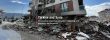
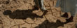
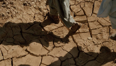
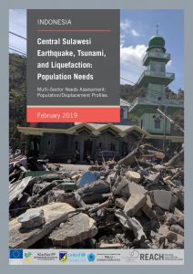
On the 28th of September, a series of earthquakes struck central Sulawesi province, the strongest a 7.4 magnitude earthquake with an epicentre only 10 kilometres deep. The earthquake triggered a tsunami that hit the provincial capital Palu and the coastal city of Donggala with waves up to six meters high. The earthquake, tsunami, aftershocks and resulting liquefaction and landslides caused significant damage, loss of life and challenges for the delivery of aid in the worst affected areas.
Since the onset of the disaster, IMPACT, through its humanitarian data initiative REACH, supported the Government of Indonesia and the PP Cluster by assessing the scale of the damage through remote sensing. With the aid of satellite images, the collaboration resulted in a series of maps identifying, for example, damaged buildings, displacement sites and locations of liquefaction and landslides. The rapid deployment soon developed to a humanitarian needs and shelter assessment of disaster-affected areas.


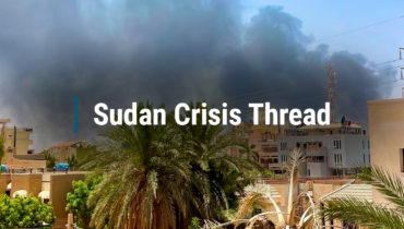
Clashes between the Sudanese Armed Forces (SAF) and the Rapid Support Forces (RSF) broke out on 15 April 2023. Fighting has been concentrated in densely populated urban centres, starting in Khartoum but quickly spreading across the country. These clashes have triggered waves of forced displacement, both internally as well as to neighbouring countries, including Central […]

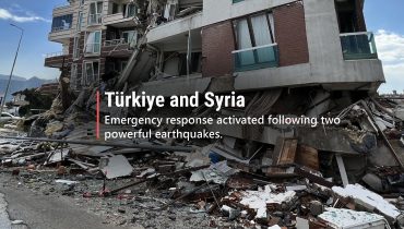

As of the 14 of March 2023, this thread has been archived. To see future updates on Syria, see our latest news section and for more information products, check out our REACH Syria page Two powerful earthquakes struck south-eastern Türkiye within a span of 12 hours on the 6th of February. The first, with a […]


Today marks International Women’s Day, an annual global event intended to celebrate women’s achievements while also calling for greater gender equality and equity. To commemorate the milestone this year, we explored the application of gender-inclusive approaches in humanitarian research, specifically needs assessments that are conducted with representatives from crisis-affected communities in the world’s largest humanitarian […]


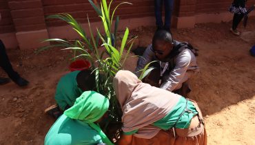

As an homage to the victims of the Kouré attack of August 2020, a shared project to build a school has been set up with families of the victims. It is implemented by ACTED, IMPACT and Léo Pour Le Monde. Since October 3rd, the school welcomes 180 pupils in middle school, and from Year 2 […]


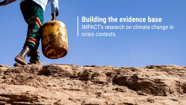
The COP27 climate summit kicked off this week in Sharm El-Sheikh, Egypt. As parties to the climate change treaty gather to review annual progress on reducing carbon emissions, one key issue at the forefront for many activists is the impact the climate crisis is having on poorer countries. These nations bear the brunt of erratic […]


IMPACT Initiatives, notably via its REACH, AGORA, and PANDA initiatives, is increasingly committing research efforts to inform the aid community on how to tackle climate risk. The objective? To identify evidence-based solutions that can be applied in fragile contexts to strengthen the resilience of communities. How? By conducting scientifically robust risk assessments, working with local actors to develop a better understanding of risk, and building local analytical and communication capacities.


As of the 6 of October 2022, this thread has been archived. To see future updates on Ukraine, see our latest news section and for more information products, check out our REACH Ukraine page FIRST 100 DAYS OF THE UKRAINE WAR As conflict in Ukraine continues, the gravity of the humanitarian situation is clear. People […]


IDN_Factsheet_MSNA_Sub District Palu Regency_February 2019_ID
PDF2.5M

IDN_Factsheet_MSNA_Sub District Parigi Moutong Regency_February 2019_EN
PDF1.8M


IDN_Report_MSNA_Central Sulawesi_February 2019_EN
PDF1.5M


IDN_Factsheet_MSNA_Sub District Parigi Moutong Regency_February 2019_ID
PDF1.7M


IDN_Report_MSNA_Central Sulawesi_February 2019_ID
PDF1.4M


IDN_Factsheet_MSNA_Sub District Sigi Regency_February 2019_EN
PDF4.3M

IDN_Factsheet_MSNA_HH_Displacement Status_Central Sulawesi_February 2019_EN
PDF1.4M


IDN_Factsheet_MSNA_Sub District Sigi Regency_February 2019_ID
PDF4.1M


IDN_Factsheet_MSNA_HH_Displacement Status_Central Sulawesi_February 2019_ID
PDF1.4M


IDN_Factsheet_MSNA_HH Total Population_Central Sulawesi_February 2019_EN
PDF1.4M


IDN_Factsheet_MSNA_Gender of Household Heads_Central Sulawesi_February 2019_EN
PDF1.2M


IDN_Factsheet_MSNA_HH Total Population_Central Sulawesi_February 2019_ID
PDF1.4M


IDN_Factsheet_MSNA_ Gender of Household Heads_Central Sulawesi_February 2019_ID
PDF926.4K


IDN_Factsheet_MSNA_Sub District Donggala Regency_February 2019_EN
PDF3.3M


IDN_Factsheet_MSNA_Sub District Donggala Regency_February 2019_ID
PDF3.2M


IDN_Factsheet_MSNA_Sub District Palu Regency_February 2019_EN
PDF2.5M


